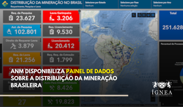
Photo: Canva/Edition ÍGNEABR
The National Mining Agency (ANM) has established clear guidelines for the standardization of geographic data and aerial survey products that must be included in technical documents submitted to the agency. These standards aim to ensure the consistency, quality, and interoperability of information, facilitating technical analysis and the management of mining processes. Compliance with these standards is a requirement for document acceptance.
The main regulations governing this standardization are ANM Resolution No. 142/2023, which addresses geographic data in general, and ANM Resolution No. 123/2022, which focuses on aerial survey products, with special attention to those obtained by Remotely Piloted Aircraft Systems (RPAS, or Drones).
Standardization of Geographic Data (ANM Resolution No. 142/2023)
This resolution applies to all geographic data present in reports, technical notes, opinions, and other technical documents submitted to ANM or produced internally. Key points include:
- Reference System: All geodetic coordinates must mandatorily be referenced to the Geocentric Reference System for the Americas – SIRGAS2000.
- Coordinate Type: Geographic features must not be represented by cartographic projections, but rather by geodetic coordinates (latitude and longitude).
- Coordinate Format: Must be expressed in degrees, minutes, and seconds, in the format “±GG:MM:SS,SSS” (e.g., -13:00:12,037 or +02:10:12,000), using a comma as the decimal separator and a plus sign (+) for North/East and a minus sign (-) for South/West.
- Vector Representation: Features must use simple geometries (point, line, polygon). Accepted formats, with specific requirements for each, are:
- Esri Shapefile (.shp, .shx, .dbf, .prj): Preferred format, files grouped in a .zip archive.
- Esri File Geodatabase (.gdb): Version 10.x or later, directory compressed in a .zip archive. Value domains should be used if applicable.
- CSV or TXT: Only for listing coordinates (points, simple lines/polygons), with a header and defined structure (feature and vertex identifiers, geometry type, latitude, longitude).
- GPX: Only for point (waypoints) and linear (tracks) features.
- GeoJSON: Must start with the type parameter set to FeatureCollection.
- Raster Representation: Accepted formats are:
- GeoTIFF (.tif): OGC GeoTIFF 1.1 standard or later. Must support BigTIFF for files > 4GB.
- ERDAS IMAGINE (.img): Must contain georeferencing information in the HFA structure. For files > 2GB, use the .ige extension (group .img and .ige files in a .zip archive).
- Attributes: Names must follow UpperCamelCase standard (e.g., ProcessoMinerario), without accents or spaces. Numeric attributes use a comma as a decimal separator. Dates follow “YYYY-MM-DD” format.
- Metadata/Dictionary: Files and services must be accompanied by a data dictionary or metadata containing at least the name, description, and data type of each attribute.
- Encoding: Use UTF-8 or Windows-1252, indicated in the metadata.
Note: Formats like Shapefile, GDB, GPX, GeoJSON, and OGC services may have their own established standards (e.g., decimal degrees with a period) that differ from the general rule of the Resolution (sexagesimal degrees with a comma). These specific standards should be followed according to the file/service type.
Parameters for Aerial Survey Products (ANM Resolution No. 123/2022)
This resolution establishes criteria for the evaluation and acceptance of products such as orthomosaics, digital terrain models (DTM), digital surface models (DSM), maps, etc., especially those generated by RPAS.
- Compliance with Geographic Data Standards: The presentation of these products must follow the recommendations of the specific geographic data standardization norm (Resolution ANM No. 142/2023).
- Positional Accuracy: Must meet the parameters of “Class A” of the Cartographic Accuracy Standard (PEC-PCD) from the Directorate of Geographic Service (DSG), or a successor/specific ANM standard. Evaluation requires independent verification points in adequate numbers. Lower classes may be accepted if defined in a specific ANM normative act.
- Altitude: Products with an altimetric component must represent the terrain surface, referenced to the geometric (ellipsoidal) altitude of SIRGAS2000, and not objects on the terrain (vegetation, buildings).
- Spatial Resolution: Must be compatible with the scale and purpose of the application.
- Technical Responsibility: Products must be accompanied by a Technical Responsibility Annotation (ART) from a qualified professional.
- Acceptance: Products not complying with the resolution will not be accepted by ANM.
Essential Observance
Adherence to these standardization norms is fundamental for the correct processing of mining applications and for the acceptance of technical documents by ANM. Non-compliance may lead to requests for adjustments (§ 3 of Art. 17 of Resolution 142/2023). Consulting the full text of ANM Resolutions No. 142/2023 and No. 123/2022 is recommended for a complete understanding of the technical requirements.
Has your company already adapted its workflows to these new requirements? Share your experiences or questions in the comments.