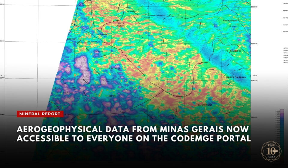
The Minas Gerais Development Company (CODEMGE), in partnership with the State Secretariat for Economic Development, has announced the free release of aerogeophysical data for the mining sector in Minas Gerais.
For the first time, aerogeophysical survey data collected at low altitudes, which previously cost up to R$ 300,000 for companies and interested parties, are now being made available at no cost to companies and researchers in the sector.
The data were gathered through aerogeophysical surveys conducted by aircraft operating at an altitude of 100 metres, capturing high-precision images and information to assist in identifying areas with mineral potential.
The information is available in digital formats such as gdb, grid, and pdf, and can be accessed on CODEMGE’s official website.
According to the company’s CEO, Sérgio Cabral, the initiative aims to strengthen the state’s economic development by providing qualified information that attracts investment to the mining sector.
The primary role of CODEMGE is to stimulate economic development by offering qualified information to the market, which can attract more companies to the mining sector in Minas Gerais,” said Cabral.
Eduardo Ruiz, CODEMGE’s mining and environmental manager, emphasised that the availability of this data can improve efficiency in mineral research. He noted that the initiative provides a robust technical foundation for decision-making in mining projects, contributing to more planned and sustainable operations.
How to Access the Data
Those interested in accessing the aerogeophysical surveys should visit the CODEMGE website and complete a specific form to obtain the data.
CODEMGE also offers, in collaboration with the Institute of Geosciences at the Federal University of Minas Gerais (UFMG) and the Geological Survey of Brazil (SGB), other geological mapping projects on the Portal of Geology.
Source: Minas Gerais Development Company – CODEMGE – Brasil Mineral

